Showing posts with label National Park. Show all posts
Showing posts with label National Park. Show all posts
Sunday, January 20, 2013
Doi Pha Hom Pok (National Park)
Doi Pha Hom Pok (National Park)
The terrain is mostly mountainous complex. As part of the Lao mountain range.
It has plenty of forest. It can be seen from the plants. Diverse and rare wildlife species. It is an important tourist destination of Chiang Mai.
There have important mountain such as Doi Pu Muen, Doi Laem and Doi fha hom pok.
The source of several major creek lines such as Huay Mae Chai, Huay Mae Saow, Nam Mae Kum Luang, Nam Mae Harng, Nam Mae Lang.
Typical weather year round with an average temperature of about 25.4 degrees Celsius is cold from November to February. Temperature ranged from 13.7 to 19.0 degrees Celsius, the maximum temperature is around 39.1 ° C in April and the wettest May to September. The featured attraction is the natural beauty. Doi Pha Hom Pok, Hot spring, Huay Mae Chai, Huai Bon Cave, Pong Num Dung waterfall, Tat Luang waterfall.
Tourist attraction
Pong Nam Ron Fang
The natural hot spring is heated by underground. A warm glow all the time. The water temperature is about 40-88 degrees and sympathizers were many wells in an area of about 10 acres (wells have hot steam rising up to 40-50 m), the National Park Service has mineral baths and a steam room. Prior to the pond is a small park. The National Park has a nature trail through the woods with his five- Species to the pond. Distance of approximately 1.2 kilometers.
Mountain biking trails
Mae Fang National Park mountain bike trails have been prepared by two routes is the Huai Bon Cave - Luang Pha - compressed air and the Pha Luang - The Little House on the Prairie - waterfall in another bin. Travelers who like to exercise and enjoy the challenge. Into contact with the nature and condition of the forest.
Doi fha hom pok
Second high mountain in thailand with a height of about 2285 meters to sea level. On top of the highest mountain meadow due to the shallow geology. Rock is granite. With the wind blowing through the air. Fun to see the beautiful view of the sea and the road on the ridge. Parallel to the border with Thailand - Burma This is a road built to international security. The evergreen forest is a forest where he had to balance the natural environment and biodiversity. As to the species of plants. Interesting and rare wildlife species such as wax moths tail Bao Imperial v. Kaiser. Malachite butterfly quilt cover. Caudal lobe butterfly glitter fade. Butterfly sword tail tan burns. Bulbul bottom yellow mask. Birds spread wings and purple in the winter migratory birds live necked Thrush. Thrush bird wing, black, gray. Thrush red-brown bird, etc. Fun quilt cover three routes, including the route of the compressed air and the sacred forests Camp Girl. Interested persons should contact the Headquarters navigation.
Sunday, July 17, 2011
Tung Salang Luang National Park
Thailand National Park
Tung Salang Luang National ParkCovers an area of Phitsanulok and Phetchabun province. There are have beautiful natural scenery and a variety of sources such as natural caves, waterfalls, meadows, rich in plants and animals. With an area of approximately 1262.55 square kilometers, announced the establishment of. "Tung Salang Luang National Park" on Saturday, January 29, 2506.
Tung Salang Luang Topography
.Tung Salang Luang National Park is a mountainous area like a cambered ripple. On the western mountains of limestone chips as long as the north - south. The middle have many high mountains with a peak elevation of about 1028 meters above sea level.That making this area have many streams, creeks, such as Khek large creek, Khek little creek, Bass River,Chomphu canal and Wangtong canals etc.
Tung Salang Luang Climate
.Tung Salang Luang National Park in the winter months from November to February. Generally the weather is very cold place ,it suitable to visit in this time. During the months of March to June it's a summer. The maximum temperature is around 29 degrees Celsius. During the rainy season from July to October the average rainfall is about 1700 mm per year. Tourist should to go in Winter recommend.
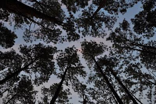
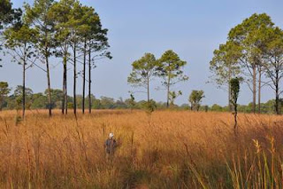
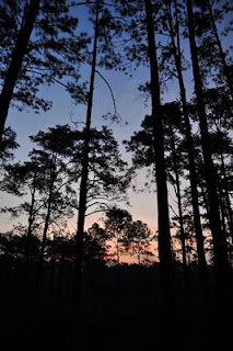
Photographer vegetation and wildlife
The forest consists of Rainforest, Dryforest and mixed forest. The principal species such as Two pine trees, Rubber, Iron Wood, Wild Mango, Red water, Maka,Teak, ked red,ked black, Padauk, Etc. The prairie is a vast open space. There are alternate pine and flowers. Wildlife animals includes elephants, tigers, deer, monkeys, langurs, wild boar, rabbits and birds and so forth. For traveler who's need to photograph animal life or bird ,this place is good to do.
More about Unseen Thailand
More about National Park khaoyai national park
Subscribe to:
Posts (Atom)